Historical Industrial Use
- Overview
- Changes to Landscape
- Historical Industrial Use
- Areas of Interest
- Environmental Concerns
- Remediation Efforts
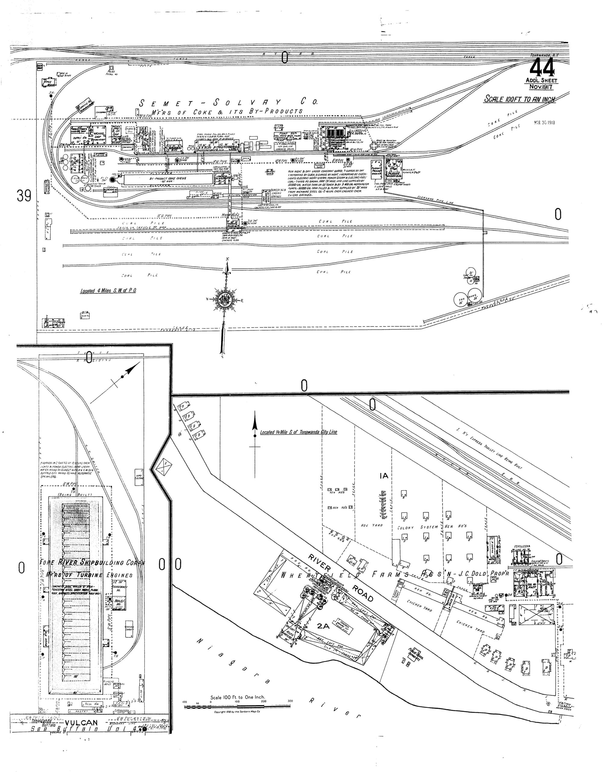
1917 Sanborn Map
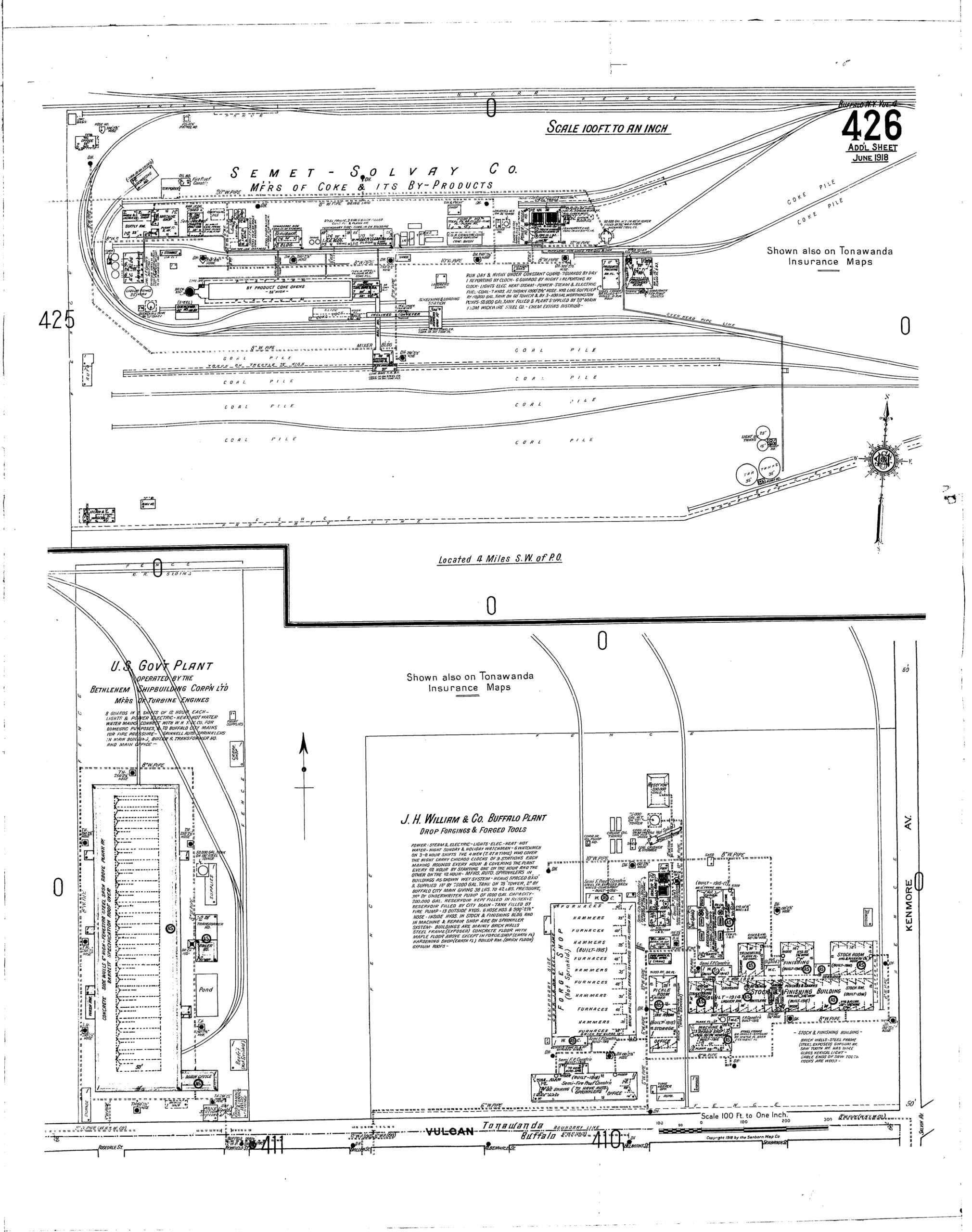
1918 Sanborn Map
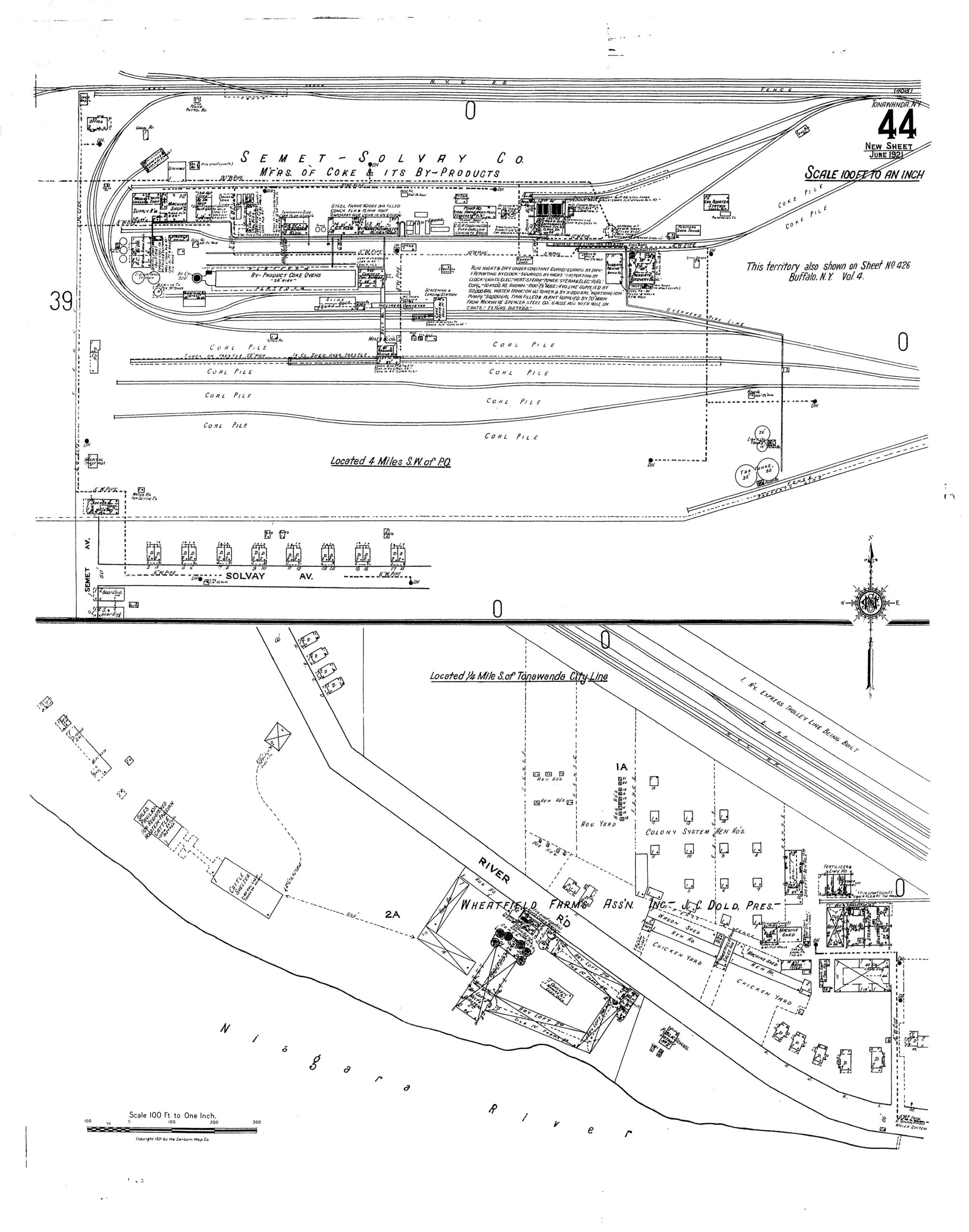
1921 Sanborn Map
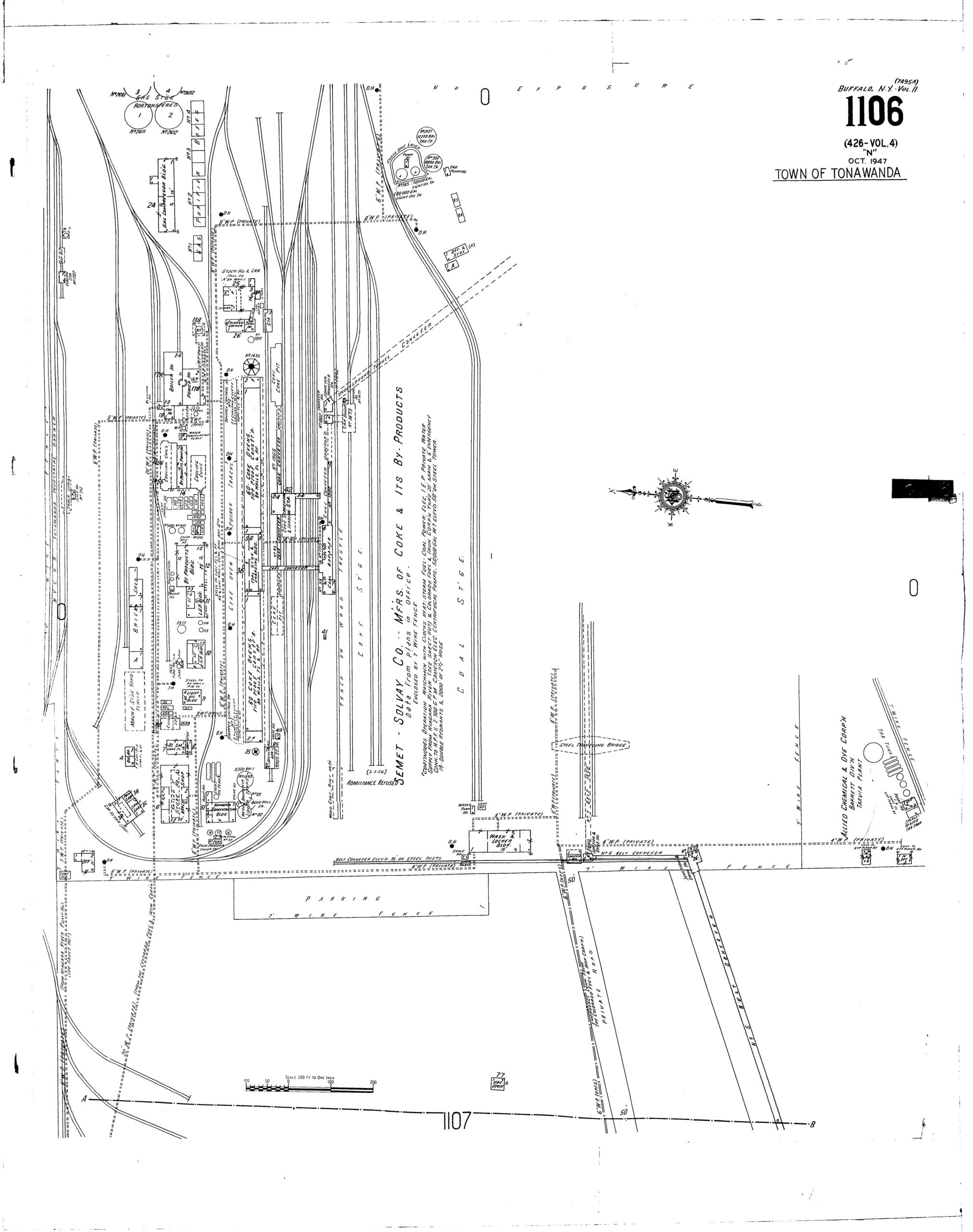
1947 Sanborn Map
1967 Sanborn Map
Building Footprints
The 100 years of activity at this site resulted in the expansion and contraction of the infrastructure that supported the production, refinement, and storage of coke oven byproducts.
Using the historical documentation, aerial phots, and first-hand information gathered from interviews of former employees, we have mapped the footprints of the current and former buildings on the BCP site.
Building Names
Using the Sanborn maps, we were able to identify the function of the building highlighted on the BCP site. We gathered information about the production process and associated by-products of coke manufacturing. We used this information to identify the flow of materials through the plant as they were transformed from raw coal to either coke or a by-product.